The three bids from consortia and companies submitted in the tender for seismic surveys in western and southern Greece, due to begin in early 2027, highlight investor interest in other offshore areas of the country beyond those already slated for exploration, as well as the potential to attract new players beyond the two US giants.
Although it may still be too early to discuss this, since we do not yet know either who will win the contracts or which offshore zones they have asked to map, the move nevertheless paves the way for a new future licensing round in Greek waters or for a player to express interest in an area after buying the “fresh” data, as happened with the blocks off Crete in Chevron’s case.
Both the three bidders and the would-be fourth, who according to reports took part in the tender but was excluded after failing to submit the required files through its own mistake, are said to be “international companies of recognised standing with extensive experience in the field”, as Energy and Environment Minister Stavros Papastavrou said.
It remains to be seen whether, in addition to PGS Exploration (UK) — the British arm of Norway’s PGS, whose interest prompted the tender — we will also see France’s CGG, with the world’s largest fleet of geophysical survey vessels, multinational SLB (one of the leading players in oilfield services), and Norway’s Shearwater GeoService.
It also remains to be seen whether the interested parties are companies or consortia, as is customary in similar cases, with one partner bringing seismic expertise and the other the vessels.
The players’ identities and possible renegotiation
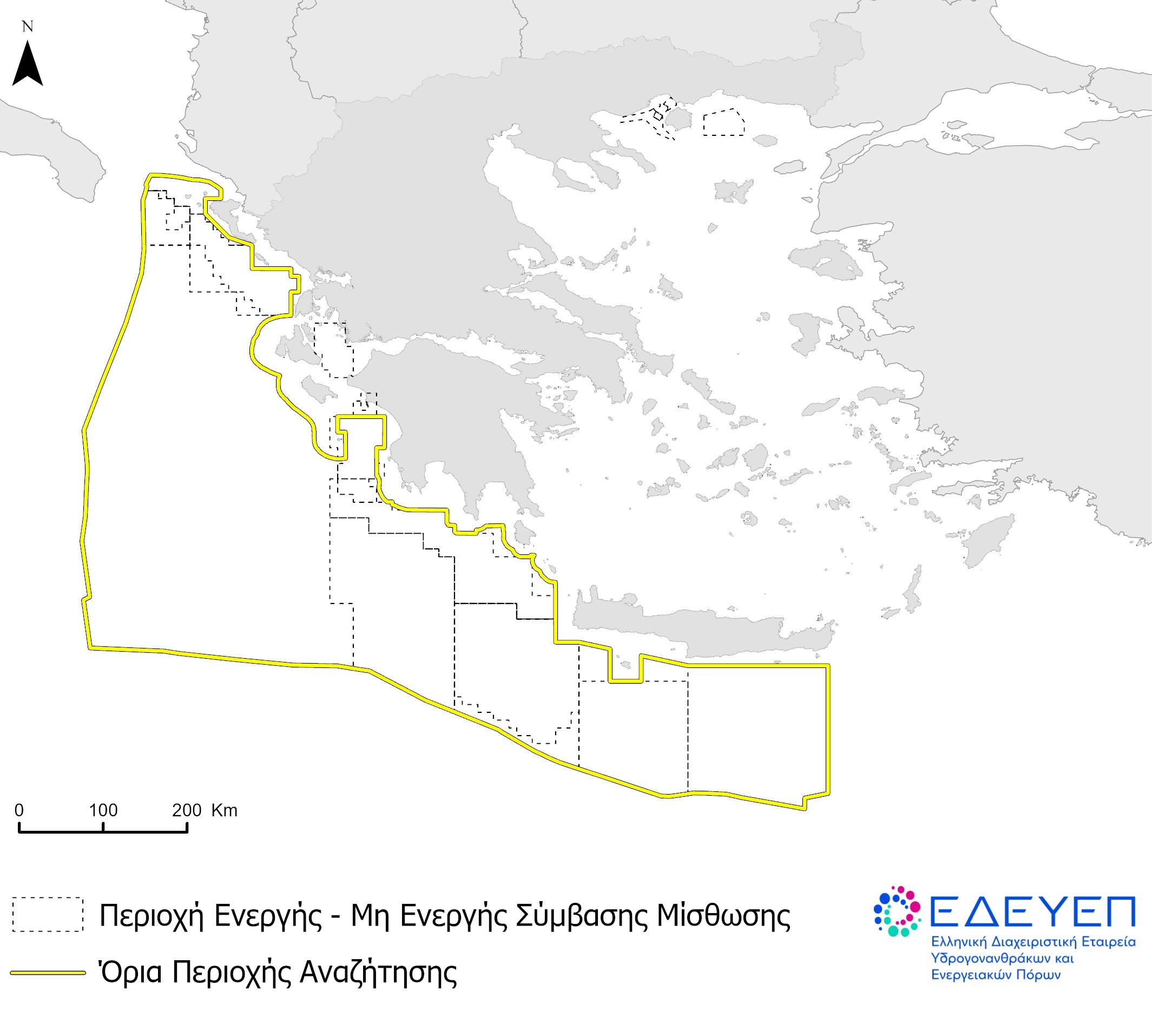
In the best-case scenario, the identities of the players competing for the new exploration programmes — which, judging by the tender map, cover an area spanning more than half of Greece’s maritime territory — will become known by the end of the week, possibly on Friday.
By then, the board of the Hellenic Hydrocarbons and Energy Resources Management Company (HEREMA) will have met and appointed the Evaluation Committee, which will open the electronic submissions.
According to reports, depending on the nature of the bids, HEREMA may negotiate with one or all three consortia to improve them and increase the financial and other benefits to the state.
It is also possible that permits will be granted to more than one company, allowing for a broader overall programme with greater geographical coverage than a single successful bidder would provide. This is particularly likely if the three bidders have not selected exactly the same areas, but their programmes complement one another geographically.
Under the tender terms, seismic survey companies can propose 2D and 3D data surveys across all or part of the area (for which their clients have presumably expressed interest).
Seismic surveys under the Maniatis model
The data generated by the mapping will be non-exclusive, meaning they can subsequently be sold to hydrocarbon companies, creating a new geological information base for areas that are either already licensed or still open.
The model is the same one used by the state during the first licensing round in Greek waters under Yannis Maniatis, when he was minister (2012-2013).
At the time, Norway’s PGS, using the “multiclient data” model, financed the mapping of a vast offshore area and subsequently sold the seismic data (2D or 3D) to hydrocarbon companies, many of which now hold licences in Greek blocks.
In practice, “the acquisition and processing of new data, using the most advanced technologies, will help create a more comprehensive database, both for licensed and unlicensed offshore areas. This is an important prerequisite for further assessing our country’s prospects and attracting investor interest,” says HEREMA CEO Aristofanis Stefatos.
The same data can also be made commercially available to multiple interested parties, enabling the company that carried out the surveys to recoup its costs and make a profit.
As for ownership of the data, it remains with the state, while the successful bidders acquire commercial exploitation rights for a period to be determined under the tender. Compensation will also be paid to HEREMA, either as a percentage of data sales or in amounts linked to agreements for making the data available.